

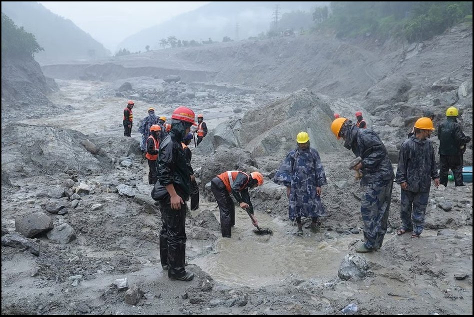
Rescue Operations in Nepal after the Flashflood | PM_nepal_/X


Introduction
The catastrophic flooding in the Nepal–Tibet Himalayan region on August 26, 2026, revealed the vulnerability of local communities and critical infrastructure. An initially localised geological event quickly escalated into a sequence of landslides and avalanches, river blockages, and temporary reservoir formation, ultimately triggering destructive downstream floods after natural barriers failed.
The glacier’s collapse extended beyond the immediate disaster area. Because of the narrow, densely populated Himalayan valleys, the rapid movement of water, rock, and sediment from destroyed roads, bridges, hydropower facilities, and residences disrupted communications and access to affected regions.
This disaster pattern serves as a warning not only to Kathmandu but also to numerous cities in India and other downstream countries. Major disasters can originate dozens of kilometres away, yet interconnected river systems produce significant transboundary effects. These dynamics underscore the necessity of disaster preparedness, hydrological monitoring, and regional information-sharing.
The Himalayan Cascade
The Himalaya produces cascades, not isolated disasters. Initial reports attributed the August 2026 disaster to a moderate earthquake that destabilised a glacier and triggered flooding. However, ensuing scientific analyses have challenged this interpretation.
The seismic signal detected in the region was later evaluated by the US Geological Survey as being associated with the massive collapse itself rather than necessarily representing a conventional tectonic earthquake. Satellite observations and scientific assessments increasingly pointed towards a large glacial ice-and-rock collapse that transformed into a devastating downstream flood. The exact chain of triggers remains a matter for ongoing scientific investigation.
The fact that a massive mountain collapse can itself generate seismic signals detectable by monitoring networks tells us something substantial about the future of Himalayan science: earthquakes, landslides, glacier failures, and floods cannot always be compartmentalised. A seismograph may record the consequences of a mountain collapse. The real unit of analysis is not a single hazard- it is the entire chain of consequences. The sequence is deceptively simple but scientifically formidable. A mountain slope becomes unstable because of geological weakness, changing ice conditions, rainfall or seismic disturbance. The resulting collapse can block a river, create a temporary lake and, when that barrier fails, unleash a destructive mixture of water, sediment and debris downstream. Each stage changes the nature of the hazard, and each offers a different opportunity for monitoring, warning, and intervention.

2026 Nepal Event Reporting | USGS (2015 Nepal Landslides; Chamoli 2021), ICIMOD HI-WISE & GLOF Assessments
Past Lessons from the Himalayas
History is full of warnings; Nepal’s recent experience should be contextualised within the country’s longstanding exposure to cascading Himalayan hazards. While the human tragedy was immense, the earthquake also revealed another dimension of Himalayan vulnerability: the mountains themselves began to fail.
Detailed mapping by the US Geological Survey found that the earthquake and its aftershocks triggered about 25,000 landslides across more than 30,000 square kilometres of Nepal's and China's Greater and Lesser Himalaya. The earthquake cannot be seen as a simple tremor; it became a landscape-changing event. The earthquake and its aftershocks destabilised slopes over a wide area, obstructed transportation routes, and brought considerable debris into river systems. The Himalaya had demonstrated a key principle: “The end of ground shaking is not necessarily the end of the disaster.”
India also received a similar warning in February 2021, when the Chamoli disaster struck Uttarakhand. Scientific analysis shows that about 27 million cubic meters of rock and glacier ice collapsed from the north face of Ronti Peak, triggering a destructive debris flow downstream, which resulted in more than 200 people being killed and many reported missing. The disaster brought out the Himalayan region's extreme vulnerability and how geological instability can have major consequences. Comparable disasters include the 1970 earthquake in Peru, which led to the killing of more than 18000 people, and also give the same lesson.
Why Should India Not Watch Nepal as a Spectator?
The historical record points to an uncomfortable conclusion that Nepal’s tragedy is not a foreign disaster for India. The geological processes that produced it extend across the Himalayan arc, which also extends to India. India’s Himalayan states, spanning from Jammu and Kashmir to Arunachal Pradesh and from Himachal Pradesh to Uttarakhand, exhibit many of the same vulnerabilities observed in Nepal. These include active tectonics, unstable slopes, intense rainfall, retreating glaciers, expanding infrastructure and settlements concentrated in narrow valleys. Collectively, these factors produce a complex risk environment.
Chamoli demonstrated how quickly a high-altitude collapse can become an infrastructure disaster. The Teesta basin catastrophe in Sikkim demonstrated the destructive potential of sudden changes in high-mountain water systems. Recurring landslides and extreme rainfall across Himachal Pradesh and Uttarakhand have shown that the danger is not limited to a single trigger.
The lesson is uncomfortable but unavoidable: India is not outside the Himalayan risk zone — it is inside it.
Why is the Himalaya a Natural Laboratory of Cascading Risk?
The Himalaya is among the world's most dynamic mountain systems because the collision of the Indian and Eurasian plates continues to shape. The India-Eurasia collision continues to generate deformation and seismic activity across the Himalayan arc. The two continental plates converge at a relative rate of roughly 40-50 millimetres per year, making the region one of the world’s major seismic hazard zones.
However, seismicity is only one part of the problem. The Himalaya is also a region of steep slopes, intense erosion, heavy monsoon rainfall, rapidly changing glaciers, expanding infrastructure, and densely inhabited river valleys; adding climate change to this already fragile geological system makes the equation even more complicated.
The International Centre for Integrated Mountain Development’s (ICIMOD) Himalayan assessments show that glacier mass loss in the Hindu Kush Himalaya accelerated significantly during recent decades. Under different warming scenarios, the region is projected to lose a substantial proportion of its glacier volume by the end of this century, with major consequences for water systems, slope stability and downstream communities. The danger is not simply that glaciers are melting, but the greater concern is that the entire mountain environment is changing and becoming more complex and less predictable in many critical high-mountain environments. Previously stable rock slopes can lose stability as water enters fractures, changing sediment dynamics.
A mountain that appeared stable 50 years ago may not behave the same way 50 years from now, with the next generation inheriting a Himalaya that is more complex and less predictable in many critical high-mountain environments.
ICIMOD also notes that more than 489 glacial lake outburst floods have been recorded in the Hindu Kush Himalaya since the 1800s and warns that evolving lakes and climate conditions are changing downstream risks. The future, therefore, cannot be planned on the assumption that the past is a reliable blueprint.
What is the Probability of the Next Great Himalayan Earthquake?
While scientists cannot predict the exact date, location, and magnitude of a future major earthquake, they can estimate long-term probabilities and hazard levels. The Himalaya is unquestionably a region of high seismic hazard. Nepal’s own earthquake monitoring institutions describe the country as lying within one of the world’s active continental collision zones and note the long history of destructive Himalayan earthquakes, including the magnitude-8 Bihar-Nepal earthquake of 1934 and the Mw 7.8 Gorkha earthquake of 2015.
The central question is not: “Can we predict the next earthquake?” Rather, it is: “Are our dams, roads, bridges, hospitals, hydropower projects and communities prepared for the intensity of shaking-and the cascading hazards-that science tells us are possible?”. This is the solution we need to seek, and in many places, quite urgently.
In many places, the answer requires urgent improvement. My own work with Indian rivers has repeatedly reinforced one central truth: a river remembers everything; it carries the consequences of its catchment— the rainfall, the sediment, the eroded soil, the broken rocks, the memory of landslides — and in the Himalaya, it can carry the consequences of a mountain failure far beyond the point where that failure occurred.
This matters especially for transboundary systems such as the Siang-Brahmaputra. The Siang begins as the Yarlung Tsangpo in Tibet, enters India through Arunachal Pradesh, becomes part of the Brahmaputra system and eventually reaches Bangladesh. Its journey connects some of the world's most dramatic geological and ecological landscapes. As a result, disturbances in the upper catchment do not necessarily stay there only. An unstable slope upstream can later result in sedimentation downstream, and an extreme rainfall event can become a flood downstream. Similarly, a glacier failure can become a humanitarian emergency downstream. This is why I have long argued that successful river management must begin upstream and move downstream.
Disturbances in upper catchments eventually travel through the system as floods, erosion, sedimentation, and ecological stress. Nepal’s recent catastrophe gives this principle a new urgency. Therefore, successful disaster management must also begin upstream-and anticipate what may travel downstream.
Can Dams and Reservoirs Become Part of the Solution?
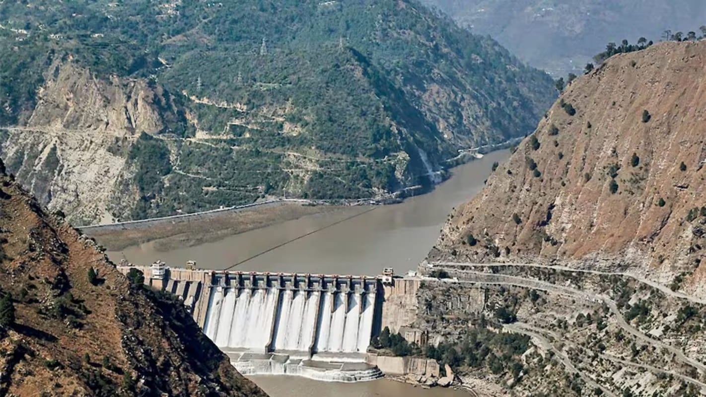
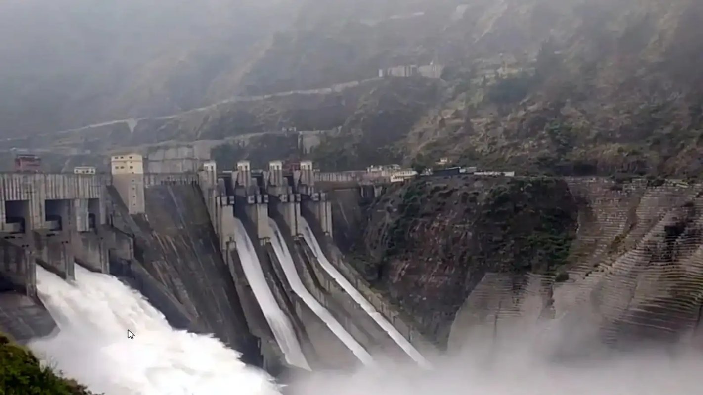
If we are scientifically precise, a dam cannot stop an earthquake, nor can any large reservoir be described as protection against seismic disasters. Dams located in seismically active mountains require rigorous geological investigation, advanced structural design and continuous safety assessment. Additionally, reservoir-induced changes in stress and pore pressure are themselves subjects of serious scientific concern in some geological settings. Therefore, the argument is not that more dams automatically mean greater safety but rather that safety demands a more sophisticated calculus.
A properly sited, independently reviewed, seismically resilient and intelligently operated reservoir may help reduce certain secondary consequences of extreme hydrological events - but the emphasis must be on the word may.
Where genuine flood-storage capacity exists, a reservoir can potentially moderate part of a downstream flood peak. Where emergency operating systems remain functional after an earthquake, water infrastructure can help sustain essential services. Reservoirs can also become strategic observation nodes within a larger river-monitoring network. But infrastructure must first survive. So, a Himalayan dam should not be judged only by the question, “How many megawatts will it generate?” but also by: What happens if a landslide enters the reservoir? What happens if an upstream river is suddenly blocked? What happens if communication and power fail simultaneously? What happens to downstream communities if emergency gates cannot operate?
Building a Mountain-to-River Intelligence Network
The future of Himalayan infrastructure does not lie merely in stronger concrete but in intelligent resilience, with the dam of the future becoming a scientific sentinel. This is where India has a major policy opportunity. Every critical Himalayan reservoir should gradually become part of an integrated observation network.
If there is a system in which seismic stations detect unusual ground movement, satellite radar detects slope deformation, optical satellites identify a fresh scar or glacier collapse, and river gauges register an abnormal fall in downstream flow - or a sudden rise in upstream water levels signalling a possible blockage. Artificial intelligence combines these signals and compares them with historical patterns. Then reservoir operators receive immediate alerts, and district authorities are warned. Communities downstream receive evacuation instructions.
Much of the technology already exists; what is lacking is their integration. Therefore, the Himalaya needs a Mountain-to-River Intelligence Network - one that connects seismology, hydrology, glaciology, satellite science, engineering and local knowledge. The future of disaster management should not depend upon one sensor, one satellite or one control room.
It must be based on redundancy. If a flood gauge fails, satellite data should continue. If mobile networks collapse, radio and sirens should function. If roads are destroyed, drones and helicopters should provide rapid reconnaissance. If cloud cover prevents optical satellite observation, radar should help fill the gap. The warning system should be designed to survive the disaster.
The Himalayan Digital Twin
An intervention India could seriously consider is ‘Himalayan Digital Twin for Cascading Disasters’. This would not be merely a decorative computer model but a continuously updated digital representation of critical Himalayan catchments, integrating seismic records, satellite observations, glacier changes, rainfall forecasts, river discharge, reservoir levels, slope movement and infrastructure exposure. The system could simulate possible chains of events. For example, ‘if this slope fails, where will the debris travel?’ Or, ‘if the natural dam breaches, which bridges and settlements lie within the flood path?’ It could potentially answer questions like, ‘How much warning time is available?’, ‘Which reservoir operations are technically feasible?’, and ‘Which roads must remain open for evacuation?’ This would transform disaster management from a culture of explanation after tragedy to a culture of prediction before tragedy. The 21st century should not purely be the century of smart cities. For the Himalaya, it must become the century of smart mountains and intelligent rivers.
The next generation deserves a different development model. However, the greatest mistake would be to conclude that the answer is either “build everything” or “build nothing”. The Himalaya needs neither blind development nor blind opposition - it needs scientific development.
Every major intervention should be reviewed through three connected systems, such as:
Grey infrastructure - dams, bridges, tunnels, retaining structures & engineered protection systems;
Green infrastructure - forests, slope restoration, vegetation, wetlands & ecological stabilisation; and
Blue infrastructure - rivers, floodplains, reservoirs, springs & groundwater systems.
This approach would better mitigate ecological disasters, as the future lies in integration.
Concrete alone cannot stabilise an entire mountain. Forests alone cannot protect every settlement from a catastrophic rock avalanche. Technology alone cannot replace local knowledge. And traditional knowledge alone cannot monitor an entire transboundary Himalayan basin. Resilience will come from combining them. The Himalaya needs both artificial intelligence and human intelligence.
The Final Warning from Nepal
After every great disaster, people tend to believe the event was exceptional. And while sometimes it is, the processes that produced it often are not exceptional at all. Mountain collapse, glacier retreat, seismic shaking, landslides, river blockages, debris flows, floods, and infrastructure exposure have shown that threats in the Himalayas are not imaginary; they are part of physical reality. What is changing is the number of people, roads, power projects, hotels and settlements now occupying vulnerable landscapes—and the accelerating transformation of the cryosphere under a warming climate.
The Himalayas cannot be made risk-free; however, disasters need not always become inevitable tragedies. We may not be able to predict the exact moment when the mountain fails. But we can map vulnerable slopes, monitor glaciers, strengthen infrastructure, design reservoirs for multi-hazard conditions, share information across borders, and prepare communities. We can build redundancy into warning systems.
When the mountain falls, the river remembers. Whether the next natural hazard becomes a national catastrophe will increasingly depend on the quality of our science, our infrastructure, and our political imagination.
[The article is exclusive to NatStrat. The views expressed by the author(s) are personal and do not necessarily reflect the views of the organisation.]
Separating Reality from the Rhetoric: Facts, Fiction, and the Indus Waters Treaty

Hedging Without Punishment: Vietnam, India, and the Unequal Burden of Strategic Autonomy