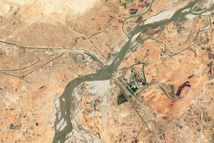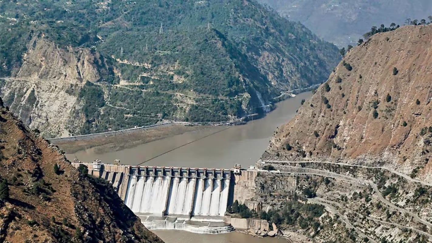


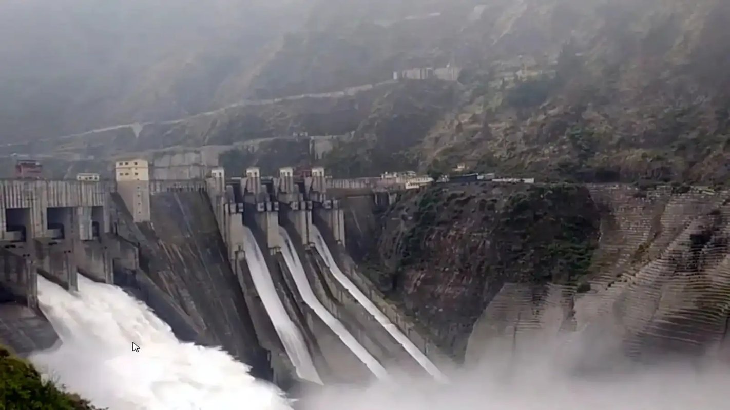
Baglihar Dam on the Chenab River | The Economic Times

The Indus basin has become a unique global anomaly in which India, as the upper riparian state, is denied its natural rights to utilise rivers flowing through its territory for essential water needs and contingency storage. Meanwhile, Pakistan, as the lower riparian state, allows nearly twice that volume to be lost through systemic wastage and unutilized discharge into the sea.
Introduction
The Indus Water Treaty (IWT), signed in Karachi on September 19, 1960, by Indian Prime Minister Jawaharlal Nehru and Pakistani President Ayub Khan, represented a landmark water-sharing agreement. Negotiated under the World Bank's auspices, the Treaty was intended to secure peace and stability for both nations. However, technological advancements have since surpassed the original intent and provisions of the Treaty. Currently, the Treaty’s technical parameters are widely regarded as outdated, rendering its framework inflexible and static.
The Indus River Basin
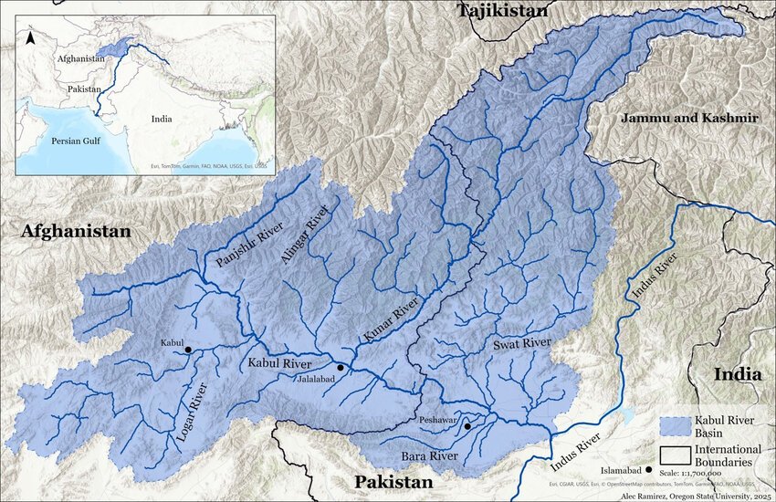
The Indus River system, known as ‘Sindhu’ in Vedic texts, comprises two principal river systems: the Kabul River, a significant right-bank tributary originating in Afghanistan and joining the Indus just upstream of Attock in Pakistan, and the Panjnad (‘Panchnad’), which marks the confluence of the Jhelum (‘Vitasta’), Chenab (‘Asikni’), Satluj, and Ravi rivers with the Indus. The Beas River, also part of the Indus system, merges with the Satluj in Indian territory upstream of the Harike barrage.
As per the Indus Water Treaty (IWT), the Indus, Jhelum and Chenab are classified as the ‘Western Rivers’, whereas the Ravi, Beas, and Satluj are designated as the ‘Eastern Rivers’. This Indus system ultimately discharges into the Arabian Sea south of Karachi.
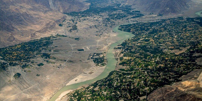
The Indus River originates in Tibet (Mansarovar) near Demchok; it enters India upstream of Nimoo and leaves at Batalik in Kargil District, near Skardu, into Pakistan-occupied Kashmir. The Satluj River is another river that originates in Tibet from Mansarovar near Rakas Lake (Tal) and enters Pakistan downstream of Ferozepur Headworks.
The primary tributaries of the Indus system in India include the Jhelum, Satluj, Chenab, Ravi, Beas, and Ghaggar rivers. While the Indus and the Satluj rivers originate in Tibet, the remaining four major rivers, namely, the Jhelum, Chenab, Ravi, and Beas, originate within Indian territory. The Jhelum River leaves India near Chakothi on the Indian side and Muzaffarabad on the Pakistan-occupied Kashmir side. The Chenab and Ravi rivers leave India near Akhnoor and at Goina/Kakarmani village in Amritsar district, respectively. The Indus River System is shown in the figure.
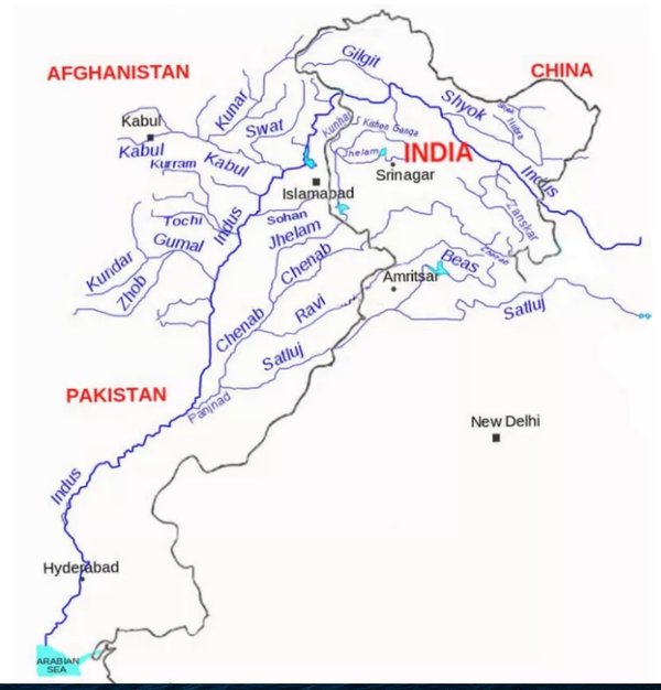
The Indus River System| PMFIAS
Held in Abeyance of IWT
Since its signing, the IWT has endured three major wars between India and Pakistan (1965, 1971, and 1999), as well as significant incidents such as the 2001 Parliament attack, the 2008 Mumbai terror attack, the 2016 Uri attack, and the 2019 Pulwama attack on a CRPF convoy. On each occasion, India refrained from taking action against the IWT.
On 22 April 2025, terrorists and groups supported by Pakistan targeted and killed 26 individuals based on religion in Pahalgam, Kashmir. Credible evidence indicated direct involvement by Pakistan, constituting a significant threat to India's national security interests and prompting India to suspend the Treaty.
Background of the Water Dispute
During the pre-independence era, a water dispute existed between the Punjab and Sindh provinces in undivided India. With the emergence of India and Pakistan after Independence in 1947, the water dispute took the shape of an international dispute.
The British Parliament passed the Indian Independence Act 1947 on 18th July, 1947. At that time, the use of river water was left to be decided by the future Governments of the two dominions, i.e., India and Pakistan.
Sir Cyril Radcliffe, Chairman of the Punjab Boundary Commission, could not lay down any arrangement for water sharing, as it was not within his terms of reference. He stated in his award, “to preserve the undivided irrigation system of the Upper Bari Doab Canal”; he could only express a hope that “a solution may be found by the Agreement between the two States for some joint control of what has hitherto been a valuable common service”.
Water Resources Distribution Immediately After Independence
Following partition, only 12 of the 143 canals in undivided Punjab were allocated to East Punjab (India), while 131 went to West Punjab (Pakistan). The most profitable and technically feasible schemes were located in West Punjab, leaving East Punjab largely deprived of development, particularly in areas distant from the rivers. The Indus plains that became part of India were significantly less developed compared to those in Pakistan.
Most of the large canals lay entirely in Pakistan and a few entirely in India. The Upper Bari Doab Canal (UBDC) was the only major canal system whose origin at Madhopur Headworks was severed by the new boundary at several places. The lower portions of several UBDC channels that went to West Punjab (Pakistan), known as the Central Bari Doab Canal (CBDC), had to receive water from the upper portions of those channels in East Punjab (India). The Dipalpur Canal, which exclusively served West Punjab (Pakistan), had its headworks at Ferozepur.
After partition, at the instance of West Punjab (Pakistan), two Chief Engineers, one each of East Punjab and West Punjab, entered into an Agreement on 20th December, 1947 to continue the status quo ante on the UBDC and Ferozepur Headworks till 31st March, 1948. Deliberately or accidentally, West Punjab (Pakistan) did not take any step until 31st March, 1948, to negotiate any Agreement with East Punjab regarding the supply of water to the Central Bari Doab Canal and Dipalpu Canal. In the absence of any Agreement, East Punjab, on 1st April, 1948, discontinued use of its installations for the benefit of CBDC in West Punjab.
Central Bari Doab Canal and Dipalpur canals irrigated only six per cent of Pakistan's total irrigated area. Chaudhuri Muhammed Ali, then Secretary General of Pakistan and later its Prime Minister, said: “… on part of the West Punjab there was neglect of duty, complacency and lack of common prudence – which had disastrous consequences for Pakistan”.
Pakistan created a false narrative that India turned off water from all six rivers on 1st April, 1948. On 16th December, 1952, M. Zafrulla Khan, Pakistan’s Representative in the Security Council debate stated: “… On 1 April, 1948, … India turned off the waters of these rivers which used to flow into Pakistan”. Ironically, the record of the meeting shows no doubt cast on the accuracy of this statement by any permanent or temporary member of the Security Council.
Pakistan created a completely false narrative in the Security Council in 1952. It is evident that after independence on 15th August, 1947, India had not constructed any structure on any of these six rivers during the 9 months till 31st March, 1948, which could control the water of all six rivers. Pakistan’s representative in 1952 succeeded in misguiding the Security Council. M. Zafrulla Khan did not mention, nor was he questioned in the Security Council, about the mechanism to turn off the flow of the water and India’s capacity to channel or store the water of these six mighty rivers for six weeks. Through this false narrative, Pakistan’s representative in 1952 succeeded in misguiding the Security Council and the world.
Imbalance in Water Distribution in Indus Water Treaty
Under the Indus Water Treaty, India received exclusive rights to the waters of the Eastern rivers, estimated at 40.7 BCM (33 MAF), while Pakistan was granted use of the entire Western rivers, estimated at 168 to 170 BCM (135 to 140 MAF). Notably, India is allocated only approximately 19.6 per cent of the Indus system's water, despite possessing nearly double the catchment area corresponding to this share. Conversely, Pakistan receives about 81 per cent of the water, even though only half of the relevant catchment area lies within its territory.
According to the 1941 census, the population depending on the waters of the Indus system was 25 million (54 per cent) in Pakistan and 21 million (46 per cent) in India. Forty-six per cent of the population on the Indian side received only 19.6 per cent of the water, whereas 54 per cent of the population in Pakistan’s Punjab received around 80 per cent. Of the 26 million acre-feet of irrigated land supplied by the Indus canals, 21 million acre-feet went to Pakistan, and only 5 million acre-feet reached India. The newly imposed political environment after partition not only disrupted India's food supply line but also severed the hydrologic unity of the Indus system. It posed a serious threat to the development of several million acres of highly arid but otherwise fertile land in the Indian part of the Indus Basin.
In 2019, Pakistani officials reported receiving 168.6 BCM in the Western rivers and an additional 6.04 BCM in the Eastern rivers. Pakistan receives 19 to 28 million acre-feet (MAF) of water from the Kabul River in Afghanistan. Of the total water in the Indus system, around 40 MAF flows to the Arabian Sea due to inefficiencies in Pakistan’s water system.
Pakistan was given a disproportionate and excess share of water despite having a lesser catchment area. In contrast, India faces acute water shortages in the states of Punjab, Haryana, Rajasthan, and the National Capital Region of Delhi.
Water Crisis in Indian States
In the Indian State of Punjab, net dynamic groundwater resources are 21.44 MCM (million cubic meters). In contrast, net draft (groundwater pumping) is 31.16 MCM, leading to a groundwater deficit of 9.72 MCM each year. Thus, the stage of groundwater development for Punjab state in India as a whole is 145 per cent, and the State falls under the “over- exploited” category. In most parts of Punjab, the groundwater table is more than 200 m to 300 m below the surface. Out of the State's area of 5.03 million hectares (ha), 4.32 million hectares have a severe problem of falling groundwater levels.
Similarly, the Indian State of Haryana (carved out of Punjab in 1966), having an area of 4.42 million hectares, is suffering badly and is under severe water stress. The State of Rajasthan, which has the Thar Desert, receives only 83 mm of annual rainfall in its Jaisalmer district. Large stretches of land in Rajasthan, a state with many communities affected by temperatures above 50 degrees Celsius, are covered by desert dunes. Water availability for Rajasthan's growing population is under severe stress.
In addition, Indus basin States in India are characterised by an increasing population and decreasing per capita water availability. The Indus basin has a strong strategic component in the country's overall food security and socio-economic development. The States of Punjab and Haryana, which account for 4 per cent of India's total population, produce 25 per cent of total wheat production. The State of Punjab, known as the breadbasket of India, is facing a water crisis. Meeting the water requirements of the States of Punjab, Haryana, and Rajasthan in the Indus basin is vital to support their financial and human development and ensure food security for more than 1.4 billion people in India.
False Narrative Building by Pakistan
Similar to its approach in 1952, Pakistan continues to promote a misleading narrative. Central to these allegations is the claim that India manipulates river flows to induce droughts in Pakistan, while also being accused of causing floods during the monsoon season. Pakistan has amplified this rhetoric on international platforms. In making these accusations of upstream manipulation, particularly regarding flow fluctuations in the Chenab River, Pakistan disregards both the hydrological realities of water availability and the established operational practices of run-of-the-river hydropower projects.
For instance, transboundary water was framed as a "weaponised global common" during a major policy seminar titled "Transboundary Water Resources: A Weaponised Global Common," held in Brussels and co-organised by the Centre for European Policy Studies (CEPS) and Pakistan's Mission to the EU. Similarly, during the International Seminar titled "The Indus Waters Treaty: An Instrument of Peace and Regional Stability", held at the Jinnah Convention Centre in Islamabad on 30th June,2026, Pakistan sought to draw parallels between the Indus River and critical global maritime chokepoints like the Strait of Hormuz and the Suez Canal. By doing so, it argued that the international community must establish global norms to prevent upstream nations from utilising water for geopolitical coercion. Ultimately, building such false narratives proves counterproductive to regional cooperation.
A Pakistani Cabinet Minister reportedly threatened to "chop off" the hands of anyone constructing diversion structures on the Western rivers. Similarly, during an address to the Pakistani diaspora in Tampa, Florida, General Asim Munir issued direct military and nuclear threats against India. Among these threats, he warned that Pakistan would launch missile strikes to destroy any future Indian dams built on the Indus River basin. Such statements significantly heighten tensions. Both sides must refrain from issuing provocative remarks that only serve to inflame public opinion across the border.
Conclusion
Pakistan receives more than 80 per cent of the water from the Indus River system, while India has been allocated only 33 MAF. Even within this share of 33 MAF, around 5 to 6 MAF still flows to Pakistan due to local site constraints. Currently, Pakistan is using around 140 MAF of water. Of the total Indus system water available in Pakistan, approximately 30 to 40 MAF escapes unutilized into the Arabian Sea, while an additional around 30 MAF is lost due to operational inefficiencies and unlined irrigation canals.
Consequently, Pakistan's system suffers an aggregate annual loss of more than 60 MAF. This systematic wastage of 60 MAF of water out of a total available water of around 140 MAF in Pakistan, compared with India’s restricted usage of around 28 MAF as the upper riparian state, starkly illustrates the current imbalance in the Indus basin. Even while accounting for the mandatory ecological baseline of 8.6 MAF of water flow below the Kotri barrage near Hyderabad/Jamshoro and upstream from Karachi, as recommended by the International Panel of Experts in Pakistan, around 52 MAF is wasted within Pakistan's water management system.
Instead of advancing unsustainable rhetoric in domestic and international forums, Pakistan should prioritise reducing internal water wastage and optimising resource management to promote regional peace and stability in South Asia.
Furthermore, India has to adopt the best international sediment management practices on the Western rivers, such as hydraulic sluicing via low-level under-sluices, mirroring the exact technical standards Pakistan employs for its own dam projects already constructed as well as under construction. Also, operation and maintenance of hydroelectric projects on the Western rivers in India must align with the best international practices.
Threats like “chop off hands” of people who construct water structures on the Western rivers in India by the Pakistan’s Minister and “using missiles to destroy water infrastructure” as well as direct military and nuclear threats against India by General Asif Munir of Pakistan in Tampa, Florida thus, creating false narrative for its own public as well as at the international forums are not sustainable and are not in the interest of both countries.
The Indus basin has thus become a unique global anomaly in which India, as the upper riparian state, is denied its natural rights to utilise rivers flowing through its territory for essential water needs and contingency storage. Meanwhile, Pakistan, as the lower riparian state, allows nearly twice that volume to be lost through systemic wastage and unutilized discharge into the sea.
[The article is exclusive to NatStrat. The views expressed by the author(s) are personal and do not necessarily reflect the views of the organisation.]